EOCI WORKS………
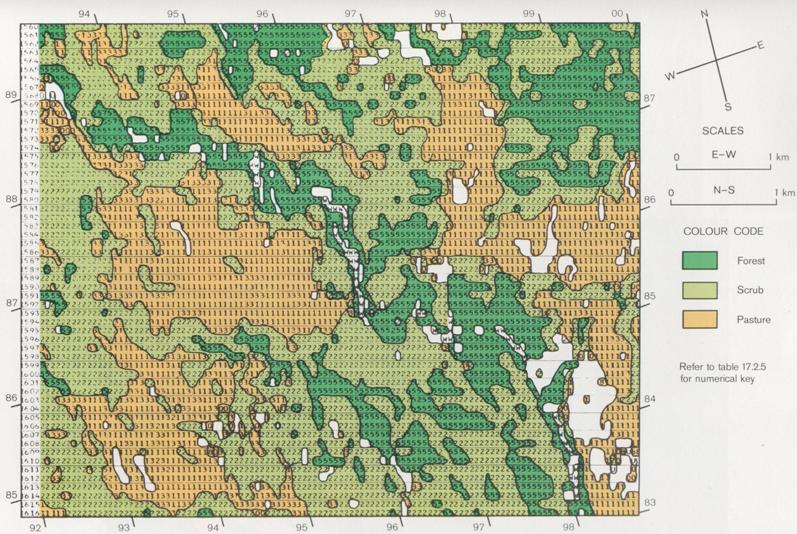 Deduced Land Cover Map Example
Picture Credit: MOWD, DSIR(NZ)
WITH USERS in Two-Way Partnership To Understand the Use of Earth Observation / Remote Sensing in Their Requirements
PROVIDES Advice and Consultancy In the Science, Applications and Policy of Earth Observation / Remote Sensing
Has PRACTICAL Expertise For each consultant, Over 20 years of Experience in the Field and with Users
Is Neutral, IMPARTIAL and Operates “in confidence” A Code of Practice provides governance to EOCI Activities
Has INTERNATIONAL Awareness and Spread: UK; Western Europe; South Asia; South East Asia; Australia; New Zealand; Pacific Islands; Antarctica; and the USA.
Is willing to take Instructions for EXPERT WITNESS Assessments, In Assessments of Applications of Earth Observation / Remote Sensing to the Environment Working Impartially with Clients